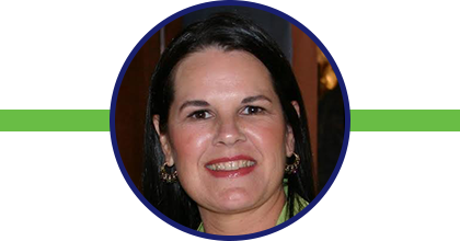
About Our Founder
Fran HArvey, gisp
A native of Louisiana, Harvey earned her Bachelor of Science degree in Environmental Studies and Political Science from the University of California, Santa Barbara. While working in the environmental field, she was introduced to Geographic Information Systems (“GIS”) technology. After spending five years in the disaster response and recovery industry as a Senior GIS Analyst, she pursued an advanced degree in GIS from the University of Denver.
In the environmental field, Harvey served as an Environmental Scientist and GIS Analyst at the Louisiana Department of Environmental Quality from 1993 to 2004. She acquired GIS skills through on the job training and utilized her expertise while working at IEM in the aftermath of Hurricanes Katrina and Rita. At IEM, she worked as a GIS Specialist/FEMA JFO GIU Unit through 2006 to support the disaster response and recovery teams to maintain situational awareness of potential disaster-related events within the Gulf Coast Area.
In 2007, she became a Senior GIS Analyst/Wetlands Assessment Team Lead at the Natural Resource Professionals. She was responsible for identifying and delineating wetlands for permitting purposes of Section 404 of Clean Water Act. In the summer of 2009, in response to Hurricane Ike, Harvey went to work at Dewberry as a Senior GIS Analyst on assignment in Texas. She created FEMA grant applications and reviewed and processed Public Assistance Project Worksheets with specific emphasis on the impact of the damage to Environmental Planning and Historic Preservation as a result of the storm.
After the British Petroleum (BP) offshore oil spill in 2010, Harvey worked as a Senior GIS Analyst at Governor's Office of Homeland Security and Emergency Preparedness (GOSHEP) where she provided GIS services to Department of Natural Resources (DNR) to support GOHSEP and Emergency Operations Center (EOC).
Although GIS has always been stepped in academia and government institutions, Harvey saw the unlimited possibility for GIS applications in business. In 2012, after receiving her certificate from the University of Denver, she established Global Geospatial Solutions, LLC, a GIS firm with the vision of bringing GIS knowledge and tool to the private sector.
In 2014, Harvey founded the Louisiana Remote Sensing (RS) and Geographic Information System (GIS) Institute, a non-profit corporation (doing business as Global Geospatial Institute) whose mission is to foster learning about the earth, its inhabitants and the use of Remote Sensing (RS) science and Geographic Information Systems (GIS) technology. In response to the global GIS software leader, ESRI, offering ArcGIS Online software to every K-12 school nationwide as no costs Harvey dedicated several years, privately funded toward educational outreach.
Harvey is alumni of ESRI’s T3G Institute (Teachers Teaching Teachers), where she completed professional development programs in 2014 and 2017. Since 2012 she has served as the President of Global Spatial Solutions, LLC, a company that offers training on how to use specialized Geographic Information System (GIS) technology and Remote Sensing (RS) imagery to improve their existing presentation and communication of technical information and data analysis. In addition to providing students K-12 and teachers with the training and support they need with hands on project-based learning, she has laid the groundwork for GIS awareness through programs such as
Maps & Apps, International
GIS Day and
Mighty Map Institute.
Currently, Harvey is serving in a leadership role for several organizations related to the geospatial field:
Board Member, Board of Directors, Pennington Biomedical Research Foundation; 2022 to Present.
A firm believer in giving back to the community, Harvey has served and continues to serve on varies board and committees for such organizations as Woman’s Hospital, Louisiana State University Museum of Art, and the Congregation of Saint Joseph ministries.